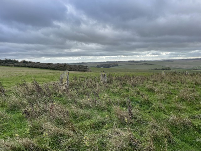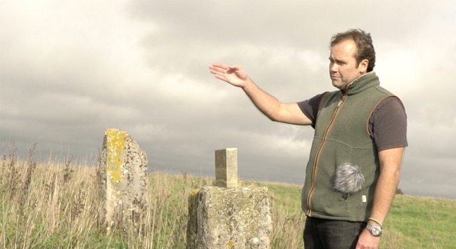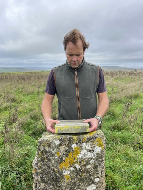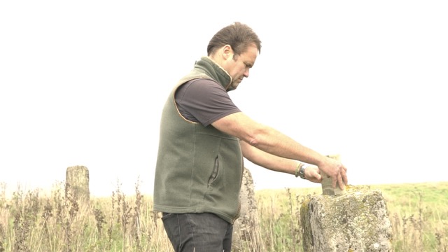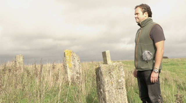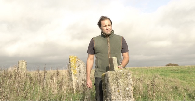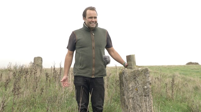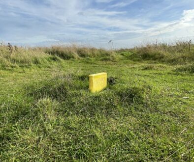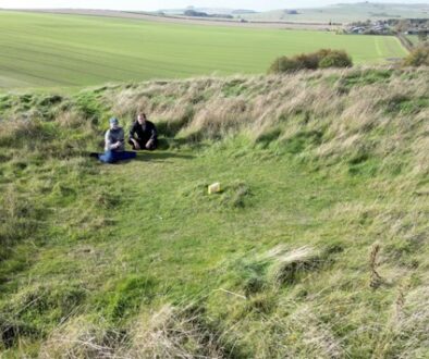
The WEARTH placement 4A1A ‘TRUFLE’ combines a contemporary land art placement with a circle that is reminiscent of Neolithic Celtic placements, but is probably only a few hundred years old. The man who created this stone circle was obviously a fan of this culture of our ancestors, who knew how important it is to speak to that of which we are an important part: the earth and the genius loci of the here and now.
is the name of the place of our first WEARTH land art placement in the first triangle of the first hexagon on the British Islands (territory 4).
Brixton Deverill is a small village and civil parish about 4 miles (6.4 km) south of Warminster in Wiltshire, England.
The parish is in the Deverill Valley which carries the upper waters of the River Wylye. The six villages of the valley – Kingston Deverill, Monkton Deverill, Brixton, Hill Deverill, Longbridge Deverill and Crockerton – are known as the Deverills.
History
There was a Roman road on Pertwood Down, about 1.2 miles (2 km) south-east of the village. The remains of a large Roman villa were discovered during the laying of a cable in a garden in the village in 2015. Subsequent excavations by archaeologists from Historic England and The Salisbury Museum found a mosaic floor from the mid-4th century, belonging to a grand villa arranged around three sides of a courtyard. A Roman stone coffin, suitable for a child, which was being used as a plant pot, was also found.
In 1086, Domesday Book recorded a settlement called Devrel with 25 households, a church and a mill, on land held by the Abbey of Bec-Hellouin, Normandy. The lord in 1068 had been the Saxon Brictric, resulting in the ‘Brixton’ prefix to the placename. The abbey lost control of the estate during the wars with France, and in the 1440s Brixton was granted to King’s College, Cambridge, who held it until 1941.
The Manor, immediately north of the church, has a 15th-century house at its core and was much enlarged in the 17th and 18th centuries; a 15th-century stone exterior doorway is now internal.The south-east block has an 18th-century staircase described as “good” by Julian Orbach.
17th-century buildings include (south of the village) George’s Barn, a pair of semi-detached cottages extended on both sides in the 18th century, all with thatched roofs.
The population of the parish peaked in the 1860s and 1870s, standing at 227 at the 1871 census, then fell sharply to 69 in 1901. The next century saw only a small increase, reaching 83 in 2011.
And it is also the home of our co-creator’s family, the Linde-Mahony family.
Metaphysical Gravitation
More...
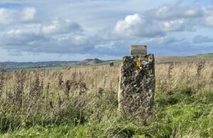
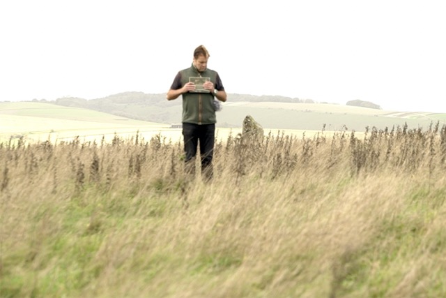
On a hill above the river Wylye is a circle of stones.
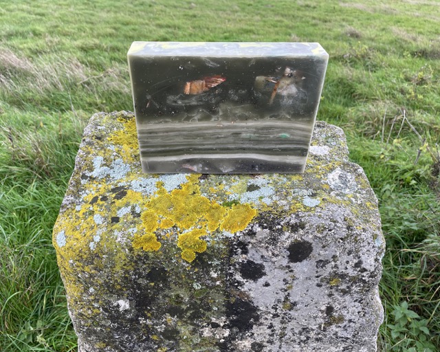
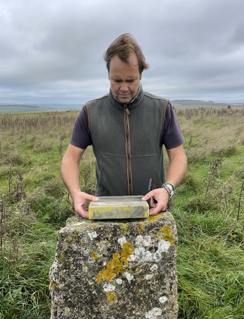
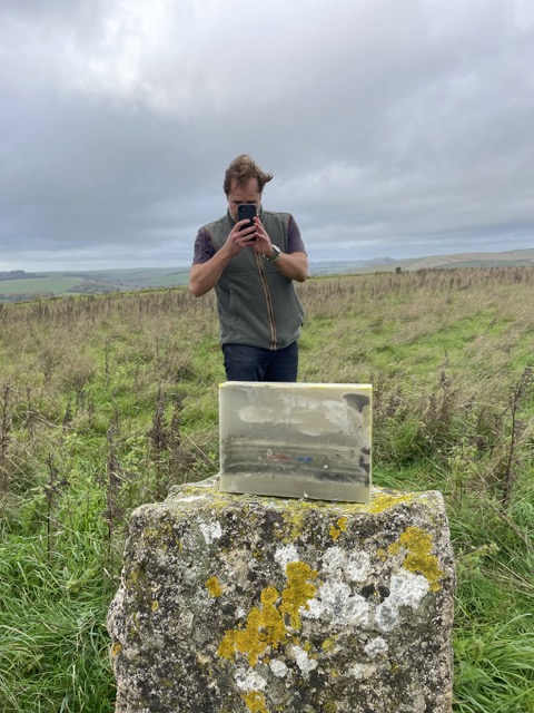
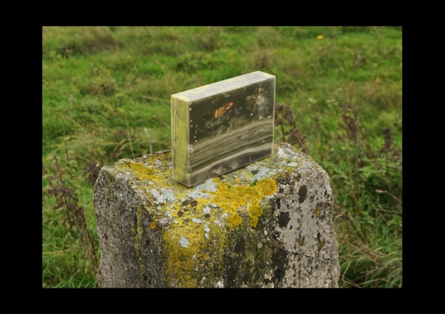
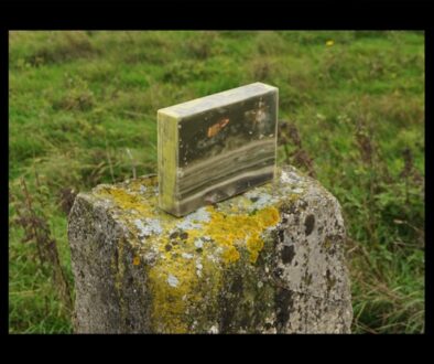
One of these stones is used as a plinth by 4A1A (partial sculpture of the first global sculpture of humanity).
This stone circle is certainly several hundred if not thousands of years old, but it is definitely a copy of the land art works from the Neolithic period, the product of a fan with a similar mindset to our Celtic ancestors.
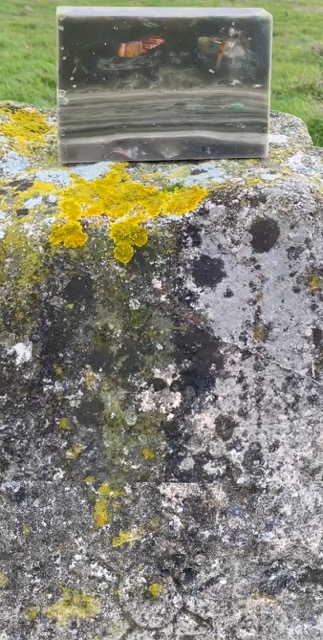
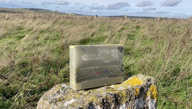
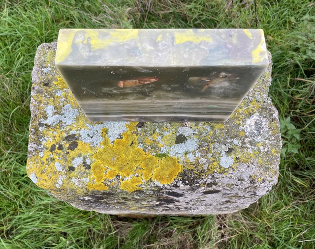
The colours of the WEARTH waxstone are very similar to the stones with the yellow lichen growing on them. The horizontal layers of the stone ‘TRUFLE’ are reminiscent of the sediments of time and flowing riverbeds.
River Wylye
The River Wylye (/ˈwaɪli/ WY-lee), also known in its upper reaches as the River Deverill, is a chalk stream in Wiltshire, England, with clear water flowing over gravel. It is popular with fly fishermen. A half-mile stretch of the river and three lakes in Warminster are a local nature reserve.
Course
The Wylye rises at Kilmington in the southwestern corner of Wiltshire and then disappears underground, reappearing at Coombe Barn, west of Kingston Deverill. It then flows north through the Deverill Valley towards Warminster. From here it turns southeast to flow through the Wylye Valley, which skirts the southern edge of Salisbury Plain. At Wilton, the Wylye empties into the Nadder, which itself empties into the Avon at Salisbury. The Avon eventually drains into the English Channel at Christchurch. The Wylye is fed by several winterbournes, which commonly dry up completely in the summer, so that the water flow in the river can vary greatly according to the time of year.
Features
Two SSSIs are associated with the river: Steeple Langford Down and Wylye and Church Dean Downs. The Wylye Valley Vineyard is at Crockerton, near the river’s source.
Water quality
The Environment Agency measures the water quality of the river systems in England. Each is given an overall ecological status, which may be one of five levels: high, good, moderate, poor and bad. There are several components that are used to determine this, including biological status, which looks at the quantity and varieties of invertebrates, angiosperms and fish. Chemical status, which compares the concentrations of various chemicals against known safe concentrations, is rated good or fail.
Water quality of the Wylye in 2019:
| Section | Ecological Status | Chemical Status | Overall Status | Length | Catchment | Channel |
|---|---|---|---|---|---|---|
| Wylye (Headwaters) | Poor | Fail | Poor | 19.035 km (11.828 mi) | 87.746 km2 (33.879 sq mi) | |
| Wylye (Middle) | Moderate | Fail | Moderate | 40.013 km (24.863 mi) | 122.421 km2 (47.267 sq mi) | |
| Wylye (Lower) | Good | Fail | Moderate | 15.775 km (9.802 mi) | 21.74 km2 (8.39 sq mi) |
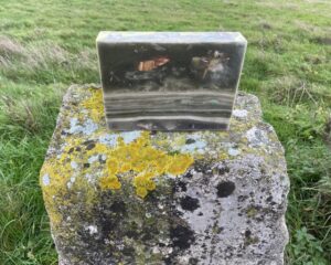
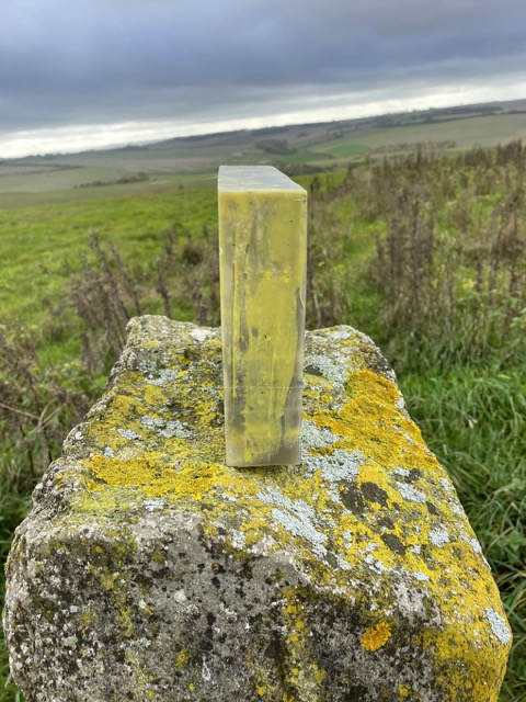
If you observe the encaustic WEARTH wax brick closely, you will see many similarities with the place where it was placed. On the one hand, there are the colours in the grey-olive range, which extend to a dirty white, and on the other hand, there are the yellow tones (better to be seen on other photos on this page), which match the yellow colour of the lichen on the stone/stones of the circle with a Celtic look. The way our co-creator Stefan placed the stone is in a landscape format, his drawings show layers not unlike sedimentary rocks. The horizontal format of this stone is poetically juxtaposed with the Wylye river flowing in the valley. The upper part of the stone is like the open, changeable sky over Wiltshire at night. The inclusions are in blue and red (I have already mentioned the dirty white) and are reminiscent of the colours of the flag of the United Kingdom (to be seen on the other side of the brick). The partial sculptures of WEARTH are all intended as land art placements that form a network that covers the globe and interacts with the earth. Here, Stefan has placed the partial sculpture in another land art work that itself originated a few hundred or a few thousand years ago. This circle of stones is reminiscent of the first land art works of the Celts, which can be found all over the British Isles.

On a hill above the river Wylye is a circle of stones.
One of these stones is used as a plinth by 4A1A (partial sculpture of the first global sculpture of humanity).
This stone circle is certainly several hundred if not thousands of years old, but it is definitely a copy of the land art works from the Neolithic period, the product of a fan with a similar mindset to our Celtic ancestors.
The colours of the WEARTH waxstone are very similar to the stones with the yellow lichen growing on them. The horizontal layers of the stone ‘TRUFLE’ are reminiscent of the sediments of time and flowing riverbeds.
River Wylye
The River Wylye (/ˈwaɪli/ WY-lee), also known in its upper reaches as the River Deverill, is a chalk stream in Wiltshire, England, with clear water flowing over gravel. It is popular with fly fishermen. A half-mile stretch of the river and three lakes in Warminster are a local nature reserve.
Course
The Wylye rises at Kilmington in the southwestern corner of Wiltshire and then disappears underground, reappearing at Coombe Barn, west of Kingston Deverill. It then flows north through the Deverill Valley towards Warminster. From here it turns southeast to flow through the Wylye Valley, which skirts the southern edge of Salisbury Plain. At Wilton, the Wylye empties into the Nadder, which itself empties into the Avon at Salisbury. The Avon eventually drains into the English Channel at Christchurch. The Wylye is fed by several winterbournes, which commonly dry up completely in the summer, so that the water flow in the river can vary greatly according to the time of year.
Features
Two SSSIs are associated with the river: Steeple Langford Down and Wylye and Church Dean Downs. The Wylye Valley Vineyard is at Crockerton, near the river’s source.
Water quality
The Environment Agency measures the water quality of the river systems in England. Each is given an overall ecological status, which may be one of five levels: high, good, moderate, poor and bad. There are several components that are used to determine this, including biological status, which looks at the quantity and varieties of invertebrates, angiosperms and fish. Chemical status, which compares the concentrations of various chemicals against known safe concentrations, is rated good or fail.
Water quality of the Wylye in 2019:
| Section | Ecological Status | Chemical Status | Overall Status | Length | Catchment | Channel |
|---|---|---|---|---|---|---|
| Wylye (Headwaters) | Poor | Fail | Poor | 19.035 km (11.828 mi) | 87.746 km2 (33.879 sq mi) | |
| Wylye (Middle) | Moderate | Fail | Moderate | 40.013 km (24.863 mi) | 122.421 km2 (47.267 sq mi) | |
| Wylye (Lower) | Good | Fail | Moderate | 15.775 km (9.802 mi) | 21.74 km2 (8.39 sq mi) |

If you observe the encaustic WEARTH wax brick closely, you will see many similarities with the place where it was placed. On the one hand, there are the colours in the grey-olive range, which extend to a dirty white, and on the other hand, there are the yellow tones (better to be seen on other photos on this page), which match the yellow colour of the lichen on the stone/stones of the circle with a Celtic look. The way our co-creator Stefan placed the stone is in a landscape format, his drawings show layers not unlike sedimentary rocks. The horizontal format of this stone is poetically juxtaposed with the Wylye river flowing in the valley. The upper part of the stone is like the open, changeable sky over Wiltshire at night. The inclusions are in blue and red (I have already mentioned the dirty white) and are reminiscent of the colours of the flag of the United Kingdom (to be seen on the other side of the brick). The partial sculptures of WEARTH are all intended as land art placements that form a network that covers the globe and interacts with the earth. Here, Stefan has placed the partial sculpture in another land art work that itself originated a few hundred or a few thousand years ago. This circle of stones is reminiscent of the first land art works of the Celts, which can be found all over the British Isles.
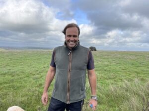
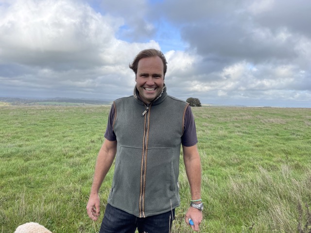
As I have already mentioned, the first placement in the British Isles took place with Stefan L. Stefan is not just any (although there is no such thing, since I know about the uniqueness of every human being; so let’s rather say he is very important to me) co-creator of WEARTH, but with him the first placement of an encaustic partial sculpture ever began in the phase of the prototypes. That was in the Sonora Desert in Mexico. There we had an encounter with someone who, for me at the time, was only a concept, a name from the educated bourgeois context: Alexander von Humboldt. In a remote village of indigenous people (the main language there
is Nahuatl), we finally found an old man who could explain to us in Castilian why a Humboldt stele was pointing towards the scorching sun in the Zocalo of his village in the middle of nowhere. ‘He was the first European to ask.’ Now you also know the meaning of the word ‘EAR’ in WEARTH.
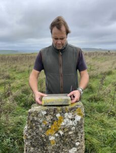
When placing ‘TRUFLE’ on this windy autumn day, Stefan very carefully chooses the direction, position and orientation, whether it should be a portrait variant emphasising the vertical or the horizontal orientation facing the landscape. It took a moment for Stefan to find the right stele within the ‘Celtic’ Land Art circle. The one he chose also had carved marks, the meaning of which probably had something to do with the local selection of the circle’s position within the larger landscape structure of the surrounding area. Ultimately, however, we did not receive a clear answer to this question, so this must remain a more or less educated guess.
In the here and now and beyond time
More...
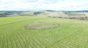
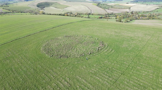
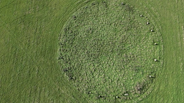
On the first day, when we made the placement 4A1A, “TRUFLE”, it was so stormy that aerial photography wasn’t possible, so we had to return the next day. From this bird’s pov, you can see that this circle consists of 22 stone steles, one has fallen to the ground or in a horizontal position.
Catch 22 or circular reasoning
Circular reasoning (Latin: circulus in probando, “circle in proving”; also known as circular logic) is a logical fallacy in which the reasoner begins with what they are trying to end with. Circular reasoning is not a formal logical fallacy, but a pragmatic defect in an argument whereby the premises are just as much in need of proof or evidence as the conclusion. As a consequence, the argument becomes a matter of faith and fails to persuade those who don’t already accept it. Circular reasoning is often of the form: “A is true because B is true; B is true because A is true.” Circularity can be difficult to detect if it involves a longer chain of propositions.
Whereas in the world of logic and other two-dimensional media, this becomes a matter of faith, it isn’t the case in the three -dimensional world: the circle exists, and can bee experienced with its effects on you. Remember, in our case, sheep wouldn’t enter the stone circle and plant population differs from outside the circle.
“Catch-22” and circular reasoning are related concepts that both deal with paradoxical or self-reinforcing logic, but they arise in different contexts.
Catch-22:
– “Origin”: The term comes from Joseph Heller’s novel *Catch-22* (1961), which describes absurd bureaucratic constraints in a military setting. In the book, the main character is caught in a paradox: pilots can only be grounded if they are deemed insane, but if they request to be grounded for insanity, it shows they are sane (because they want to avoid dangerous missions), so they must continue flying.
– “Meaning”: A “Catch-22” is a no-win situation where contradictory rules or conditions prevent any successful action. Essentially, you’re trapped because the rules work against themselves.
Circular Reasoning:
– “Definition”: Circular reasoning (also called *begging the question* or *petitio principii*) is a logical fallacy where the conclusion is assumed in one of the premises. Instead of proving something, the argument loops back to its starting point.
– “Example”: “I’m trustworthy because I always tell the truth. You know I’m telling the truth because I’m trustworthy.” Here, the statement assumes what it’s supposed to prove.
Key Difference:
– “Catch-22”: Refers to a specific situation or dilemma with contradictory rules or conditions.
– “Circular Reasoning”: Refers to a faulty argument where the reasoning goes in a circle, never providing a valid justification.
Both are frustrating situations involving illogical constraints, but “Catch-22” is more about the structure of a problem, while circular reasoning is a logical fallacy in argumentation.
Click on the photos to see some co-creation details
With brick 4A1A, *TRUFLE* we were realising with Stefan L. the first hexagonal protocol placement on the British Islands. It was at a stone circle in Brixton Deverill, Wiltshire, England.

